 |

THE 268 ACRE TOWNSHIP OF LAKENSTOWN |
|
|
THE 268 ACRE TOWNSHIP OF LAKENSTOWN |
|
![]()
SCENES, PLACES, AND HISTORY FROM
THE LIVES OF OUR
WESTMEATH
ANCESTORS

Click on the thumbnail to see a full sized map!
EMPER CHAPEL ~ St. Matthews

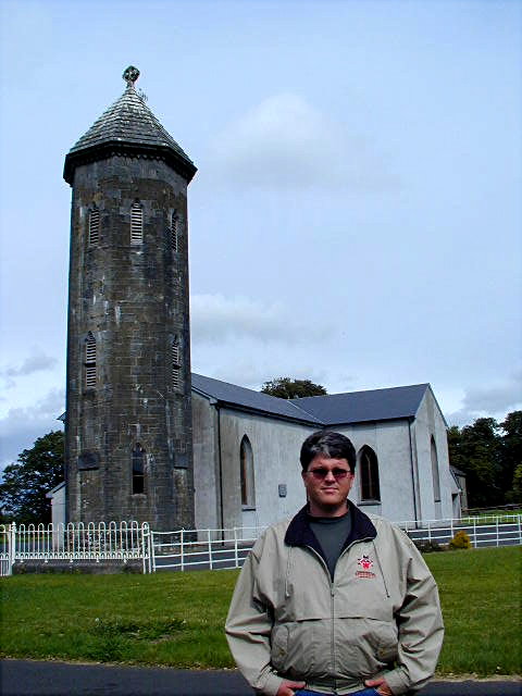
Click on the photo to see it in full sizeEmper Chapel (St. Matthews) was built in 1829; and, almost certainly, the Drew family was involved with its construction. In this 1971 photo, John Michael Drew stands outside the stone wall that surrounded Emper Chapel for more than 100 years.

Click on the photo to see it full size
29 years later, in September, 2000, the stone wall had been removed. John Michael Drew poses before the church where his great great great grandfather, John Drew was married and attended church with his family.CLICK HERE to see Emper Chapel on the detail map
CLICK HERE to see the "corner stone" atop the front of this church.
CLICK HERE to see the history of this church and the Irishtown School
| Saint Matthews MILLTOWN |
Click on the photo to see it in full size.

Click on the photo to see it in full size
Click on the photo to see it in full size.CLICK HERE to locate Milltown & St. Matthew's on the detail map.
CLICK HERE to see the 1971 photos of St. Matthews and the story and pictures of our ancestors' church records.
| IRISHTOWN SCHOOL |

Click on the photo to see it in full size.
Click on the photo to see it in full size.Click here to see the history of Irishtown School and the two local churches
| TUITE FAMILY GRAVEYARD |

Click on the photo to see it in full size
THE RUINS AT LAKENSTOWN This configuration of stone work, part of the Lakenstown ruins, plays an integral part of the tradition that the Drew families of that time were excellent stonemasons. Paddy Drew, living on the property in 1971, asserted with certainty that all the stonework in those ruins was the work of Drews... including this "round corner" which Paddy said was famous throughout several counties.
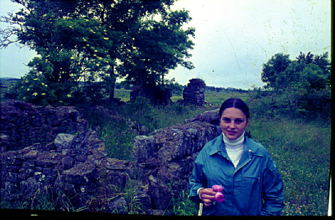
Marilyn Drew poses amidst the old stone foundations in 1971. In her hand is a sample of the beautiful roses that grow up wild among the ruins.
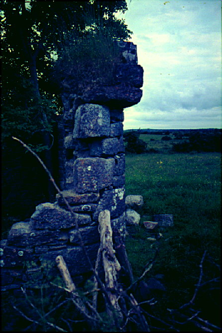
THE ROUND CORNER
CLICK HERE to see Lakenstown (College) on the detail map.
CLICK HERE to see more information on the Lakenstown Ruins
THE ROYAL CANAL
Click on the photo to see it in full size
Click on the photo to see it full size
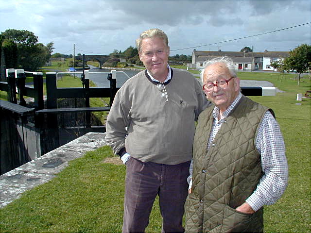
Dan Drew and Watson Mills at the lock in Ballynacarrigy, Septempber 2001. Ballynacarrigy was once a significant harbor where many barges could be docked, loaded and unloaded. In addition to the lock there are several bridges in the Ballynacarrigy area.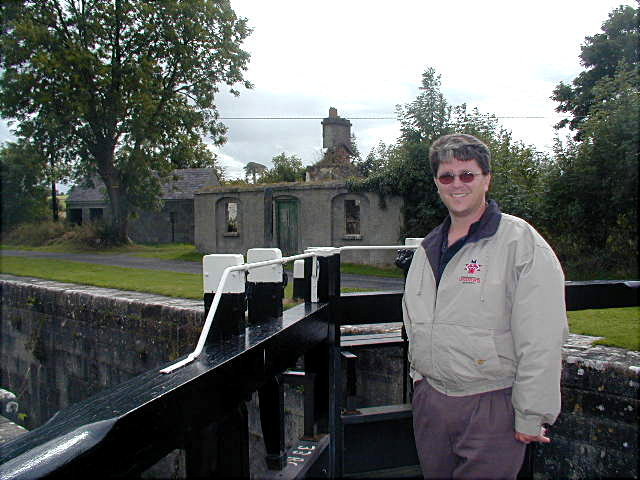
Click on the photo to see it full size
John M. Drew at the Gate of the Ballynacarrigy Lock, Septermber, 2001. The small building in the background was once a ware house used for freight along the canal. This photo shows the stonework that is prevalent along the entire route of the canal.CLICK HERE to see the Royal Canal on the detail map
ABBEYSHRULE

Click on the photo to see it in full size
John Drew poses here with our guide, Watson Mills with the famous 11th century Abbey of Abbeyshrule in the background. The abbey is located just a few miles west of Lakenstown in Longford County. We took many photos of this awesome and venerable place and also broght back some of the wild roses growing in its ruins. Both are available upon request. The place inspires one from both archetictural as well as historical perspectives.
Click on the photo to see it in full size
The town of Abbeyshrule (which means "the river crossing at the Abbey" is noted by "canal buffs" as one of the most awesome engineering feats of the Royal Canal builders. For it is here that the canal passes VERY HIGH OVER the River Inny (a Shanon tributary) by way of an imposing stone bridge or "aquaduct." In the photo above, John poses atop the aquaduct with the canal itself visible below the white railing and the river below visible over his shoulder.
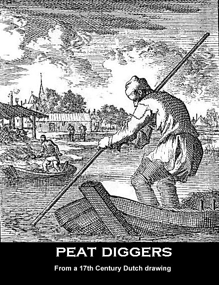
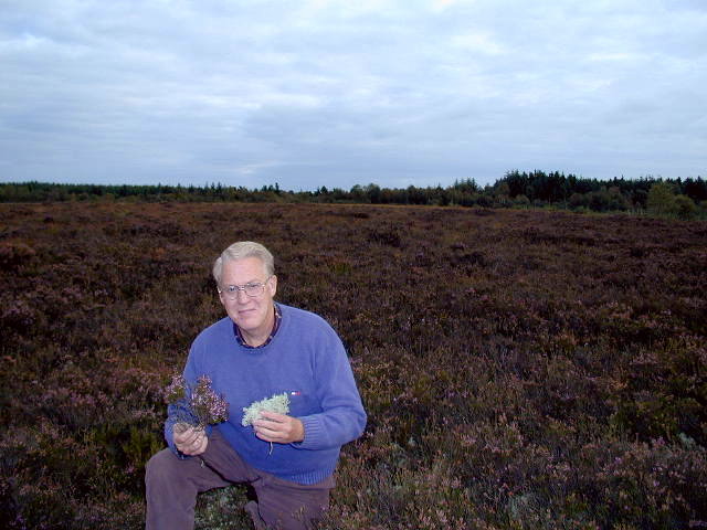
PEAT BOGGS
Click on the photo to see it in full size
Click on the photo to see it in full size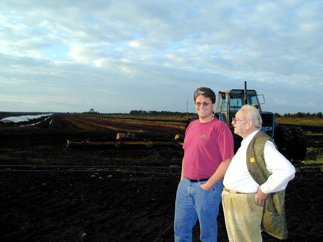
Click on the photo to see it in full size
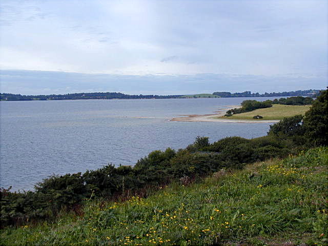
LOUGH (Lake) OWEL
MULTIFARNAM ABBEY

Click on the photo to see it in full size
Click on the photo to see it in full size
CLICK HERE to see maps and photos Lakenstown and the surrounding area. CLICK HERE to see photos of the famous "ruins" and Lakenstown itself. CLICK HERE to see photos of our Drew relatives who remained in Ireland. CLICK HERE to return to the Drew Family Index page. Use your "BACK BUTTON" to navigate back to the site from which you reached this page.

